
Walk a Bloomfield Street by Address
For a current address, start with the Township and county property tools rather than an assumed occupant list. A PROS tax result can identify the parcel, its situs, and the indexed owner. From there, the street directory process moves through map geometry and recorded documents. Each stop has a distinct purpose. A tax card is not a deed, and a voter-status result is not a streetwide roster. Keeping the source type beside each finding prevents an address trail from making claims it cannot support.
- Use Essex County PROS with Street Finder or Street Address. Save the situs address, owner, mailing address, and SBL, then set Municipality to Bloomfield to limit countywide matches.
- Open the official Bloomfield tax-map index and match the SBL to the sheet and block or lot context. The published sheets are illustrations and are not to scale.
- Use the Township-linked Bloomfield Digital Map to browse parcel geometry if it loads. If its live controls do not render, return to the tax-map sheet as the documented fallback.
- Search the owner or prior party in the PRESS public property-record search. Follow grantor and grantee directions, and retain the book/page or document number.
- Use the State voter registration status check only for a single person. The accessible research did not verify a streetwide form or its live fields.
- For permits or code matters, send a specific request through the Township OPRA form, naming the exact address, date range, and existing permit, inspection, or code record series.
- For a past street line, use the Bloomfield Public Library's 1870 to 1970 directory material, street sections, census maps, newspapers, and obituaries. Historical entries should remain dated rather than treated as a current address list.
Note: A street name can be shared elsewhere in Essex County, so the municipality, number, and parcel key are important checks before carrying a result forward.
Bloomfield Street Directory PROS Fields
PROS is the strongest public starting point for a Bloomfield street directory search because its quick form exposes several address-oriented paths. Entering a number plus street omits the suffix under the portal's example, so a search such as “5 Pine” may return more than one possible street or number. Use the displayed property card as a current tax-record lead. Its mailing field may be outside Bloomfield and is not proof that anyone lives at the parcel.
| PROS field | How it supports a Bloomfield street search |
|---|---|
| Street Address | Enter the number plus street without a suffix, then confirm the returned situs address. |
| Tax Map # / SBL | Use the tax bill or map identifier to connect a result to the correct block and lot. |
| Owner Name | Search a current or prior owner. Prefix the last name with = for the portal's exact last-name search. |
| Street Finder | Selects public Essex County roads, returns street addresses, and can be combined with a number. |
| Municipality | Choose Bloomfield to constrain similarly named streets and other countywide matches. |
The form also shows Search, Clear Search Form, an Advanced Search link, and a disclaimer agreement. The research did not capture the Advanced Search fields, coverage dates, export behavior, or a promise that every linked deed or permit opens from a parcel card. Record the assessment-year label shown on the result, and use PRESS or a records request for the underlying source.
The available PROS quick-search source is shown in this captured view.
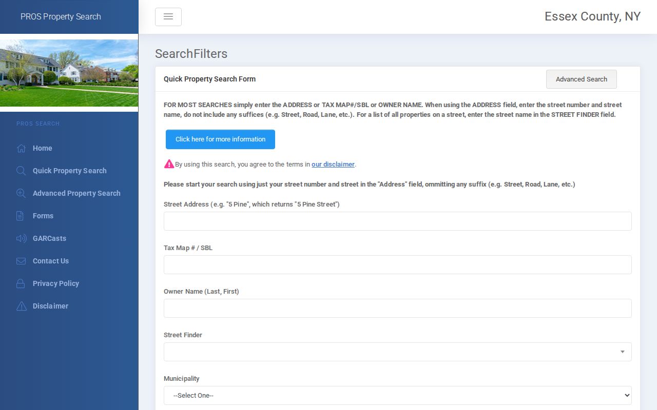
The screen supports an address-first workflow, but the returned tax information still needs its own date and parcel checks.
Bloomfield Tax Maps Link Streets and Lots
Street text is useful, but the tax map makes it possible to test whether two records describe the same parcel. Bloomfield publishes a map index with sheet 01 and sheets 03 through 34. Those sheets provide block and lot context and help with corner parcels, which may face one road while a directory uses another. The official page labels the maps illustrations only and not to scale, so they are a bridge to the SBL rather than a survey or final legal boundary.
- Parcel
- A defined piece of taxable property. In this record trail, its SBL or tax-map identifier is the key that joins PROS, a map sheet, and a deed description.
- Situs address
- The physical location of the parcel. It is the address to compare with map and street records.
- Plat / SBL
- A plat is a mapped subdivision or parcel reference. Here, SBL means the tax-map section, block, and lot style identifier used to locate property records.
- Criss-cross directory
- A reverse directory organized by address or street instead of only by name. It is useful for dated historical entries, not for proving current occupancy.
When a deed gives a subdivision, tract, block, lot, or metes-and-bounds description, copy it fully. Compare it to the PROS identifier and map sheet before deciding it belongs to the same street address. Parcel splits, merged lots, old spellings, multiple entrances, and units can make a loose street-name match unreliable.
Bloomfield Street Directory Address Keys
One Bloomfield property can carry three address clues that should not be collapsed. The situs address is the physical parcel location used for the street and map search. The mailing address is where the tax system sends correspondence and can belong to an owner, entity, or location outside the Township. The legal description is the block, lot, subdivision, or metes-and-bounds wording used in a recorded instrument. Each answers a different part of an address question.
Start the street directory with the situs and SBL, then retain the mailing address only as an indexed record clue. When a corner parcel, long lot, unit building, or older deed appears under a different street expression, compare the parcel key and full legal description before treating the records as a match. That extra check prevents a tax mailing destination from being mistaken for a current household or a road-facing address from being mistaken for a deed description.
PRESS Carries Bloomfield Street Deed Chains
The Essex County Register's PRESS interface is the recorded-document handoff in the Bloomfield street directory. Search the owner as a buyer or grantee to locate a purchase, then use the seller or grantor in an earlier search. A result's party name, role, document type, recording date, book/page or document number, and legal-description clue are the pieces needed to check a chain. A deed can point to a parcel without repeating a modern mailing address.
There is an important local coverage story. PRESS states a 10/01/1996 interface start. The Register homepage separately describes remote public internet property transactions from 05/01/2001, computerized recording and indexing from December 1988, and older books held at the Hall of Records. The Register says its deed and mortgage copies reach back to 1637. These milestones differ, so confirm the needed year with Register staff rather than treating any one date as a complete online boundary.
The PRESS public-search source appears in this captured interface.
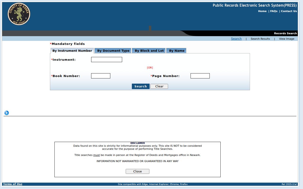
For older or incomplete results, the Hall of Records public room has books, computers, and staff who demonstrate index and book use, although staff do not conduct a title search.
Mortgage cancellations before July 2, 2012 may be indexed without an electronic image. Keep the book/page or document number as a handoff for office research, and ask whether the needed instrument is indexed under a separate document type.
Bloomfield Street Records and Their Limits
A street directory relies on several public sources, but each source has a narrower meaning than the next. The property layer identifies a parcel owner and tax characteristics. The map layer shows geometry. PRESS shows a recorded transaction. A historical directory reports a dated publication entry. Together they can form a useful address trail when the SBL, legal description, party names, and dates agree. They do not create a complete current household record.
| Address-keyed source | Local keeper | What it can add | Access and boundary |
|---|---|---|---|
| Tax and assessment card | Bloomfield Assessor / Essex PROS | Owner, mailing and situs addresses, SBL, assessment, lot, square footage, sale clues | Public PROS search; local questions at the Assessor's Office |
| Tax map | Bloomfield Township | Map sheet, block and lot context, roads, and adjacent geometry | Official sheets are illustrative and not to scale |
| SDL or NJGIN parcel context | Township-linked map / State parcel data | Parcel geometry, address, municipality, block, lot, or PIN context | Local SDL controls were not rendered; statewide owner names can be redacted |
| Recorded instrument | Essex County Register | Grantor, grantee, date, legal description, and placement number | PRESS plus Hall of Records books for older or missing material |
| Voter record | State and Essex election offices | Specified registered-voter fields subject to statute | Status is a single-person check; protected addresses and request rules apply |
| Permit or code file | Township custodian | Existing work, inspection, or case record tied to date and address | No verified public portal; use a specific OPRA request |
| Directory or census entry | Library and historical sources | Dated street or household evidence | Historical, incomplete, and not proof of a present occupant |
Note: The best address trail preserves the record date and key, since a current tax card, a recorded deed, and a published directory line describe different moments.
One Bloomfield Voter Status at a Time
New Jersey's official registration-status route is a confirmation tool for one person, not a way to browse a Bloomfield street. The accessible research could not render its live form fields or result text, so no address, date-of-birth, county, or matching tutorial belongs here. A public status result does not show a ballot selection. State law describes the statewide list as including name, address, date of birth, party affiliation, and voting history, subject to protected-person exclusions. It does not include signatures.
For a statutory list request, N.J.S.A. 19:31-18.1 governs copies and use. The research found a printed-list price of $0.25 per copy per election district and an electronic-list ceiling of $375 from a Commissioner of Registration, but no current Essex request form, file layout, or delivery format. Contact Essex County voter services for the current procedure and permitted-use certification before paying. A missing address can be a lawful protection for covered people or Address Confidentiality Program participants.
Bloomfield Street Permit Records by OPRA
No verified Bloomfield public permit or code-search portal, field list, or coverage year was located. The practical street-directory fallback is an OPRA request for existing records, not a request for the Township to investigate an address. Name the exact street number and street, a bounded date range, and the record series sought. For example, request existing permits, inspection records, and code-enforcement case records, including permit or case number, issue date, status, and public applicant or owner fields, with exempt information redacted.
Bloomfield's online OPRA request form provides the Township route. New Jersey OPRA, N.J.S.A. 47:1A-1 et seq., normally calls for a response within seven business days when records are available. Ask for the custodian's preferred electronic format and any estimated fee. The form is better than a phone request when the goal is an existing, described address log.
Bloomfield Streets Before Today’s Boundaries
A historical street entry can use Bloomfield for territory larger than the present Township. The Historical Society highlights an 1865 Bloomfield and Belleville map from before Montclair and Glen Ridge separated and before Belleville and Nutley separated. Match the map year and jurisdiction to the directory or deed year before placing an old address on a current street map. This is a geography issue, not evidence that an old address has been renumbered.
No verified official township-wide street-renumbering project or renumbering year was found. For an older address, compare the directory's street index with nearby houses, tax maps, deeds, newspapers, and the Historical Society's 1906 Mueller Atlas. The Bloomfield Public Library's directory collection covers 1870 to 1970 in Bloomfield sections of the Orange Directory, with print and digitized material. Its collection belongs to the historical side of the street trail; the modern parcel workflow remains the better route for current tax records.
A dated directory entry can be paired with a census enumeration district, an obituary, or a recorded transfer. For deeper directory collection detail, consult the Bloomfield city directory page.
Limits of a Bloomfield Street Directory
A parcel owner may be an individual, trust, or entity, and that owner is not a complete list of people at an address. A tax mailing address can be nonlocal. A multi-unit structure can have one parcel owner and several dated directory entries. Guests, utility customers, delivery customers, and other household members are not created by this record trail. Motor-vehicle address information has separate disclosure limits under the Driver's Privacy Protection Act.
Lawful use. Use Bloomfield street and address records for personal, lawful research and civic or historical questions. Do not use a public record to stalk, harass, intimidate, or harm any person.
When a result is absent, note the search terms and date. The cause may be a spelling variant, an old volume, a different document type, an unrendered portal control, a protected address, or a missing image. It is not proof that no record ever existed.